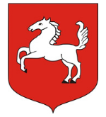
The government of Wojsławice

Mayor: Henryk Gołębiowski
The district mayor’s address: 22-120 Wojsławice, Rynek 30
tel: (082) 566 91 02
fax: (082) 566 91 02
gmina@wojslawice.eurzad.pl
www.wojslawice.eurzad.eu
The Wojsławice district is located in the Eastern part of the Lublin Upland in a subregion called “Działy Grabowieckie”. It borders with the Leśniowice and Żmudź districts in the North, with Kraśniczyn in the West, with Białopole in the East, and with Grabowiec and Uchanie in the South. The area of the district covers 110 km2. There are 4527 inhabitants (the data from 31st December 2003). They live in 23 villages of which 26 administrative units are made. The district registered office – Wojsławice is a former town. The town charter was granted in 1440, but revoked in the 19th century. Today, it functions as an administrative, trade and service as well as cultural centre. Roads of a great importance as: Chełm – Wojsławice – Grobowiec – Zamość or Lublin – Krasnystaw – Wojsławice – Hrubieszów till the border with Ukraine in Zosin constitute a base for the communications system. They create a huge opportunity to open the district in almost all directions: the Northern direction to Chełm – 27 km, the Western direction to Krasnystaw – 34 km and Lublin – 86 km, the Eastern direction to Hrubieszów – 35 km, and the Southern direction to Grabowiec – 16 km and Zamość – 34 km.
The landscape is characterized by a varied lie of the land, numerous gorges and dry valleys. Gorges in Wojsławice reaches 2 km of length at a depth ranging from several to more meters. Inhabitants call them “debry”. “Debry” have got numerous side branches creating an unique and, one can say, fabulous landscape. In the district lie of the land, one can distinguish three main parts which are parallel to one another in the West- East direction. A valley of the Wojsławka river constitutes the central part situated 200 – 230 meters above the sea level. The Wojsławka river joins the left-bank tributary called “Barbarka” in its upper reaches. In the bifurcation of these creeks, there is the Wojsławice village located on a slight hill. At the Southern side, the Wojsławka valley turns into a range of hills which constitute the main massif of Działy Grabowieckie and reach 300 meters above the sea level. The terrain raises up and down in a wavy way. Great depressions occur between crests of neighbouring waves. The massif is built on a chalk seam called “opoka” (a sedimentary rock) covered by a loess layer. It is an area of small density of river networks. There are not many springs, and the most interesting of them are located in the vicinity of Stary Majdan and Nowy Majdan. A watercourse called “Ponik” created by water from springs of the Southern part of Rozięcin village is a some kind of sensation. After crossing the village, the watercourse disappears from the ground in its Northern part.
Bigger forest clusters are located in the Northern part of the district in the region of an almost dead village Zarowie. Fragments of natural beech stands are preserved. Oak and mixed forests grow in the vicinity of Huta and Nowy Majdan villages. There are incredibly many valuable species of flora and fauna which are under law protection, for example: the steppe cherry, the Siberian squill, the speckled ground squirrel, an otter and a beaver. A beautiful landscape and a peculiar microclimate of the district attract tourists.
In this region, colonisation dates back to the Neolithic Era. Many archeological finds prove it, for example: a stone hatchet, stone pennies, urn crypts, numerous medieval kurgans, and gords in Kukawka and Nowy Majdan. A quadrangular market square and sacral monuments are perceived as the most important monuments of the ancient architecture in Wojsławice. They are: the parish church dedicated to Saint Michael the Archangel built in the late Baroque style in 1595 – 1608, the bell tower from the second half of the 18th century and five chapels built in 1762 next to all entrance roads from Wojsławice. The brick Baroque Orthodox church dedicated to the Prophet Elijah built in 1771, the bell tower made of red bricks from 1849, and the synagogue built in 1894 (renovated, function as the seat of civil registry and public library today) are also monuments.
The district area is ecologically clean. It is a farm district – 40% of population make their living from agriculture. Natural and economical conditions predispose the district to the farm production development, food processing and farm tourism. The district has got many natural, landscape and leisure advantages and an interesting countryside eagerly visited by artists.
A youth hostel near the Public Schools’ Complex in Wojsławice-Kolonia is the main sleeping accommodation (25 sleeping accommodations).
A local atmosphere is created by a weekly – on every Wednesday country fair. One can buy and sell everything here from agricultural produce to electronic appliances. This is the reason why crowds come here from not only Wojsławice but also neighbouring villages, districts and provinces as well as the Eastern border. The district is open to cooperate with investors from the outside. It has got a lot of areas to develop as fitted plots, cubic buildings, and complexes after the former District Health Centre in Wojsławice and former schools.
The district area is ecologically clean. Forests are rich in mushrooms, fruits and game animals. The landscape is extremely beautiful, people are hospitable and the government is favourably inclined towards investors. Welcome to Wojsławice.


